Google Earth: Based On Data Gathered By NASA
 Google Earth started out as the creation of Keywhole Inc., a company funded by the Central Intelligence Agency (CIA) and bought by Google in 2004. Google Earth is a virtual globe created by the superimposition of satellite imagery, geographical data and 3D images which are often created by users able to add their own data to the programme.
The project got its name in 2005, and it’s currently available to download both for personal computers and mobile devices. The version of Google Earth released to the public in 2005 was a combination of the Keywhole project and data gathered by Google as part of their Google Maps service.
The 3D imagery available on Google Earth is based on data gathered by NASA, and covers more and more parts of the Globe. Today, we are able to access 3D version of many cities in the United States, United Kingdom, Canada and many more, as well scenic views such as Mount Everest. The 3D models of towns made available by Google Earth are particularly useful for town planning or even education. Google has been keen to promote the software as an educational tool, and its comprehensive mapping and additional layers of geographical and cultural information make it a particularly useful tool in the classroom. The Historical Imagery Layer allows users to access satellite imagery of locations throughout history, an important resource for research or contextualising historical events.
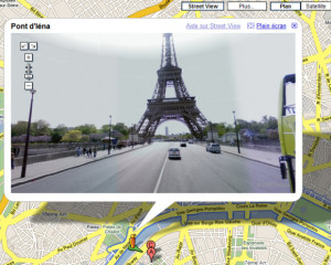
One of the more famous features of Google Earth is Google Street View, which is also available on Google Maps and allows users to access a panoramic, 360 degrees view of a certain location. Street View has multiple functional uses including planning routes, finding services such as petrol stations in the local area, and the seemingly very popular ability to access satellite images of our own homes.

Some more exciting layers of Google Earth include the flight simulator, Google Mars, Moon, and Sky Mode. The flight simulator was a hidden feature in Google Earth v4.2, although it has since been officially incorporated in all updates. It allows users to realistically fly a plane by using the keyboard, mouse or a joystick. Sky Mode is a feature that makes galaxy exploration easier and brings astronomy closer to home. Google Moon was introduced in 2009 to mark the 40th anniversary of the moon landing, and opens up satellite images of the Moon to the curious public. Google Mars was introduced in Google Earth 5 as a separate virtual globe, and includes imagery from Mars landers as well as a Mars Exploration Rover Mode.
With such incredibly varied experiences available to Google Earth users, it’s a miracle we still manage to log off our computers.
